I had been staring at the group of photos on and off for a few hours for another night.
I had looked at them before, but never really studied them deeply. Now over the past few evenings, I had been taking a much closer look. There had to be something that would help me to determine exactly where they were taken, but what was it? I hoped the location still existed. So many places have changed over time.
Finding a location where a photo was taken 70 years ago is not always easy, especially where the scenery in the image is seemingly unremarkable or nondescript when one casually looks at the picture. A picture of the Eiffel tower is relatively easy to match up. A picture of a forested mountainside with a road, much less so. I was looking at pictures of Clancy and some of the other men in the first platoon of Easy Company, 506 PIR. Interestingly, they are wearing German uniforms. They were the focal point of the image, not the scenery.
Clancy had given these photos to me in the course of our friendship. Some came when he first sent me his “dossier” of sorts, asking me to tell him who he was. That is a story in itself for another time. Some he sent to me at a later. Some of the others he gave me on a visit, only I did not realize he was giving them to me at first. We were sitting in his office chatting when he began to look around on his shelves and among his boxes. He pulled out a box of photos. He handed pictures to me to look at as we chatted. We stood side by side as we talked, he handing me one photo after another. I looked at each picture carefully. After a few pictures began to form as stack in my hand, I politely set them down next to me in a neat stack on a nearby box. He paused, looked at me and then at the photos. He reached over past me, took the stack I had set down, and put it back in my hand. He said nothing. I said nothing. He then took the next photo in the stack in the box and handed it to me and continued our discussion. That was that.
In the particular photo I was looking at now in this family of pictures, there was a wooden cross-hatch fence; a roadway the men were standing on that continued on behind them; a guard house with another small building adjacent; the base of some mountains; and a building in the far middle distance, between the men and the base of a mountain. One could mostly only see one face of the building and its roof, which was wide and had rocks on it—a not uncommon feature of many buildings in that part of Germany.

There was not a whole lot to go on in the picture itself for a specific location. Yes, it was somewhere in a mountainous region of Germany or Austria. And knowing that they had been in Bavaria in southern Germany – Berchtesgaden, and then the Kaprun area in Austria, narrowed the possibilities, but not by a whole lot on their own.
However, there was more. Clancy had told me the story of how he and his buddies had found some German uniforms up in some houses on Obersalzburg. They had gotten bored and began to poke around the ruins. With the war being over, and having a too much to drink and too little to do, they decided to try the uniforms on. Someone had a camera to record the event. The photo I was contemplating now was one of the resulting pictures. The story, along with another recorded in Stephen Ambrose’s book, Band of Brothers, narrowed the location to Berchtesgaden.
It had been almost five years since that conversation. The 70th anniversary of the end of the war was fast approaching and I was now heading to where the photos were taken. But, where exactly had they been taken? Clancy never really said. He had been gone three years. However, as I continued to prepare for the trip, I discovered there were some other sources for more information. Related photos and a few written descriptions narrowed the possibilities and led me to believe the photos were taken where Clancy and first platoon had been billeted. But where was Clancy’s platoon billeted? One question just seemed to lead to another.
The most descriptive account is found in David Webster’s published account titled, Parachute Infantry Regiment. Though I found clues in the snippets of published information in a few books, Webster’s account was by far the richest.
A related photo also gave me a clue. Ambrose, when finalizing his popular account of Easy company 506 PIR’s war history, made mention of the German Officer uniform story as described by O’Keefe:
“Sergeant Mercier….got into the spirit of the day when he dressed in a full German officer’s uniform…. Someone got the bright idea to march him over to the company orderly room and turn him in….to Captain Speirs.
Someone got word to Speirs before Mercier showed up. When trooprs brought Mercier up to Speirs’s desk….Speirs did not look up. One of the troopers….declared, ‘Sir, we have
captured this German officer. What should we do with him?”
‘Take him out and shoot him,’ Speirs replied…
.’Sir’, Mercier said, ‘sir, please, sir, it’s me, Sergeant Mercier.
‘Get out of that silly uniform,’ Speirs ordered.” (Ambrose 271)
Clancy had given me a photo of Mercier. And he was wearing part of a German uniform. This could only be a picture taken at the time of the story Ambrose described. But was this the CP? The photo would tell me. I just needed to figure out how.
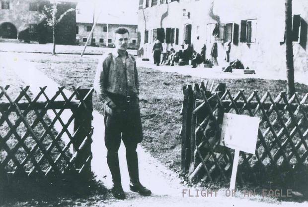
I had looked at that photo for a long time. The buildings were camouflaged. Very few were. Geoff Walden had noted on his website — Third Reich In Ruins — that at that point the only known buildings to be camouflaged were those on Obsersalzberg. (Our investigation changed that.) My initial thought was that the pictures were taken there. This bit of information then led me back to the idea the location may be somewhere on Obersalzburg. But I could find no photos that matched the layout of the buildings shown in the picture.
I decided to adjust the contrast on the photo to see if I could bring out any significant details in be buildings or elsewhere. When I darkened the contrast significantly, the writing on the sign appeared: “Easy C.P.”
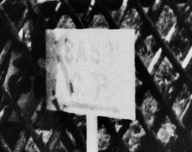
Now I knew for sure this was the location of the story told in Band of Brothers. And I knew the other photo with Clancy was taken at the same time because Mercier, more fully outfitted as a German officer, is also in the other photos. And, a careful look at the men in the background shows one of them, the one walking away from the camera, to be wearing a German officer’s uniform. It is logical to assume that the clothes hanging and piled along the wall in the background were also parts of their “costume.” So I knew the pictures were taken at the CP. But where was this photo taken in relation to that of the four of them standing together?
More recent descriptions generically state the men of 2/506 were billeted at “the” SS Barracks. The complex that most immediately comes to mind is the SS Barracks on Obersalzberg. Initially, it seemed likely that this could be the place. After all, Clancy said they were up in some officer’s houses there when they found the uniforms. I tried to match the photos to anything even the shape of a mountain, but no luck. My heart sank as I soon learned that it had all been torn down, but I also learned that it had been bombed before the 506th arrived there so it would be very unlikely they were billeted there if the place was already in ruins when they arrived.
If the photos were taken at the CP then I was sure some E/506 Company historians or tour guides would have the answer–they would know the location of the company CP. I sent inquiries to a few people who were known to be sound E/506 PIR resources, but no real response was forthcoming. I was left to my own intellect to figure this one out.
I revisited David Webster’s published account. I read through his account of their time in Berchtesgaden. Webster gave several descriptions of their billets there. One read:
“….at 2:30 a convoy of G.I trucks took us to a settlement of long, white, two-story chalets on a highway about a mile and a half north of Berchtesgaden. The new billets were laid out precisely as an Army camp and were separated from the road by a smooth lawn a hundred feet wide.” (Webster 241)
A map dated to the 60s or 70s in a college collection, which depicted one half of Berchtesgaden–the eastern half–was of some help. It did show a road leading north out of Berchtesgaden and there were some collections of buildings depicted at certain points, but they gave no hint of being, “laid out precisely as an Army camp.” Obersalzburg is to the south of Berchtesgaden. If the photos were of the billets, then it could not be Obersalzburg for yet another reason. Could their billets have been far from the CP? Webster answered the question in his description, but I could not be sure of it until a few more details were in place and the final confirmation would only come if I could find the ground and walk it.
The more I read of Berchtesgaden and the surrounding area, the more I could see it was a collection of military complex buildings, even outside of Obersalzberg. This made the search a little more daunting. But Webster’s account provided more clues.
Additional descriptions, which included the situation and interior of their billets, were in Webster’s account. He wrote:
“McCreary’s squad and mine wound up in the last chalet to the north….There were three big bedrooms in the upstairs apartment that we occupited, with full-sized living room, a separate dining rooom, a tiled lavatory with modern tub and toilet, and best of all, a large kitchen at the south end with three exposures.
The kitchen was painted warm yellow, with red flowers on the drawse and cupboards…”
(Webster 242)
He also wrote of the men standing at the edge of the compound watching a large congingent of surrending Germans walk past them for almost an hour. The contingent stretched out along the road for some distance. They were heading to a PW enclosure which was a mile down the road according to a statement made by Captain Spiers (Webster 241). There was one to the south in Strub– named Orlyk, I knew from internet searches, but this did not seem to match Webster’s descriptions unless his distance and directions were totally off. I tried to reconsile the details, but it just wasn’t working.
I had come across a webpage about the Berchtesgaden and Obersalzberg and at about the same time two different people recommended I look at that site. I had already sent an email to a Mr. Geoff Walden (the author of the site and a book on the subject) inquiring about the location of blown bridges en route to Berchtesgaden and now the CP and billets location. It was evident he knew a lot more about Berchtesgaden than most. He had been documenting the Germany of “then and now” for some time and his web page showed some pictures other 101st photograph locations. I was hopeful he had some information on the exact location.
He did respond back, providing the coordinates for a location — one he had taken another person a few years ago, that also had an interest in the billet location. I began to go back over the description provided by Webster and some other details provided in Ambrose’s account and some other accounts in Marcus Brotherton’s works. And then this stuck out at me again… A few pages further on in his account, Webster mentioned them watching surrendered Germans walk past their billets in a caravan of sorts and up the road to a PW camp (252-2). It had, until recently, been a work camp for Germany’s slave labor. I told Geoff that the location they had earlier suspected to be the billets could not be correct as there was no road heading further north to a camp from that location. It had to be a through road, not a dead-end or minor road in the area (as his location was).
Further inquiring of Geoff, I asked where there were PW camps. He told me that one also stood at what is now Winkl (where the well-known picture of Germans coming to talk to American soldiers on tanks was taken), but none of the original structures of the camp remained. Accordind to Webster, the PW camp was apparently visible from their billet compound, based on the descriptions he provided of the German campfires (252-3). Geoff suggested another location for the billets, which was along the through road that passed Stanggass and led up to Bad Reichenhall. It was a group of chalets occupied by the Nazi police at Bischofswiesen.
While it did give me a range to find the billets along the road, I would soon find this problematic in my search for the location. I would see that the place–there is a small compound– which was within a mile of the PW enclosure, was a small complex of sorts and did have chalets and some southern facing exposures. The problem with this location was that it was more than a mile and a half north of Berchtesgaden. And, it did not appear to have long, white two story chalets, though the buildings would have stood roughly 100 feet from the roadside and would seem to meet Webster’s descriptions of the interior of three bedroom apartments. This leads me to believe that Webster’s published account may have conflated two locations.
I could not yet resolve this disparity, so it was back to the photographs to look for more clues. I believed it was along this road though. Another detail convinced me it could not be too far. In one of his interviews with another E/506 veteran, Marcus Brotherton had recorded the detail in his work, We Who are Alive and Remain, how one of the men had picked up a vehicle and mentioned being near a small hospital. Norman Neitzke said:
“Near a small hospital on the outskirts of Berchtesgaden our squad was short on vehicles. We saw a nice black German ambulance and figured we’d liberate the vehicle. …Our squad leader, Tex Coombs, drove a German Airforce truck by then.” (Brotherton 179).
As I studied the Google Earth map, I found the hospital building, now disused, and it was along the same road as the police chalets. The billets could not be too far away. It had to be along that road. Interestingly, I would learn that Tex was one of Clancy’s squad leaders as well. And, he was still alive.
I began looking at other pictures to see if they held any clues to the exact location. Perhaps another picture would have the tiny guard house in it. I was not getting anywhere until I happened to look at this picture.
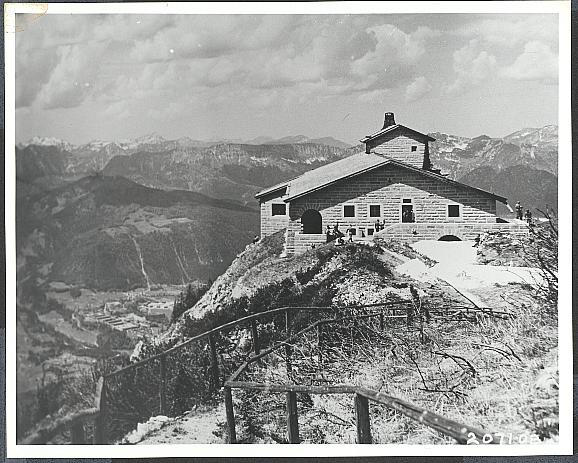
It was a photo like the one depicted here of the Eagle’s nest that got me thinking. If the picture was taken north of Berchtesgaden and on a through road, then there were a much more limited number of possibilities for the location. I looked at the marks cut into the mountain behind and to the left in the image. They were mountains north and west of Berchtesgaden. I wondered if any distinctive marks could be found in the photos of Clancy and his friends.
Sure enough there were marks on the mountain in the background in the photograph of the four men standing together. Could they be matched up to anything in any other photos? With only a few days left until my departure, I began to look through the photos in Rendezvous with Destiny, Epic of the 101st, and the Currahee Scrapbook. I was printing some of the images to bring with me and hopefully match up when I arrived in the Berchtesgaden area.
Then I saw it. A picture of the award ceremony at what is called the Chancellery caught my attention as I was flipping through the growing stack of pictures I had printed, now looking at backgrounds.
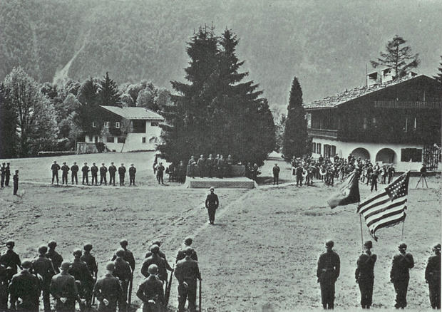
You will notice in the background of the award ceremony photo a light colored gash in the side of the mountain in the upper left section of the photo. It is most visible above the tree line and extends diagonally up the side of the mountain. When you look at the picture of Clancy and his buddies, you will find the same mark in the same general area of the photograph. The photo above is taken at the Kanzlei or Chancellery complex at Berchtesgaden. It’s location is known and the buildings in the photo still stand as evidenced on Geoff Walden’s website (http://www.thirdreichruins.com/miscbldgs2.htm). It is a feature that is also visible in the image of the Eagle’s Nest taken by the Signal Corps I posted above.
With that discovery, things began to fall into place and further unfold. As I continued to look through the photos in Epic of the 101st and in The Currahee Scrapbook another photo stood out at me. It had the guard house and the building and the gate—the same as in Clancy’s picture. I was looking at the picture sideways. I could not believe what I was seeing. I turned the book. and compared the photos. And in the foreground on the left was the same type of wooden cross-hatch fencing… The same fencing in the photo that Mercier was in. It would have been part of the view Mercier had when his photo was taken.

To the side of the road on a post is a Kangaroo sign–the callsign for the 101st HQ, and it points straight ahead down the road. The HQ was located at the Reichskanslei, which, at the time, going straight ahead at the intersection and following the road as it bent to the left, would bring you directly to the building. It still does, though additional roads and buildings now stand in the area, and other buildings are now gone. There is a sign there today marking the buidling as the HQ for the American forces.
I suspected, based on the shadows alone from the pictures Clancy gave me, that the group of four was taken at 90 degree angle from the direction of the picture Mercier. The psychology of the men standing around taking pictures made sense for that as well. You can see the uniforms and some of the men sitting on the steps of a long white building in the background of the photo of Mericer. I suspect the one walking away from the camera, still in “constume”, is Clancy as those on the steps don’t hold themselves the way he did. Other photos matched up as I worked my way out from the point of Clancy’s photo at that gatehouse. I could not wait to test the theory on the ground and see if it still stood.
I emailed Geoff and let him know my findings and shared some other pictures and my line of reasoning. All that was left was to walk the ground. And walk the ground I did. On day two of my trip to Germany I drove from Bad Reichenhall to Bechtesgaden. I arrived on the outskirts at around 9:30am of May 5th…on time with the 70 year old schedule Webster had noted. And, after a trip up to the base of the Eagle’s nest which I hiked, after stopping for a strole in a tunnel in the museum at the Dokumentation Center, and after a stop at the ruins of the Berghoff with a bottle of Champagne, I drove back down the mountain to the Kanzlei complex.
The moment of truth came. I got to the location, parked the van ( I just realized now that Clancy and his buddies had a van when they got there.), and got out and began to walk around. And, my theories proved correct. I found the intersection and I turned and there were the billets where Mercier had been standing. I could hardly believe my eyes. The shadows in the photos did not decieve.
I tried to call “Tex” Coombs several times from the parking lot at the original HQ there. I had only just gotten in contact with him to try to determine the location of another photo he was in.But, I could not get the phone number to work. I decided to try again when I got back to the hotel.
When I got back to the hotel and thought a little, a detail in the pictures began nagging me–that building in the background where Clancy and the others were standing. The one with the stones on the roof in the middle distance–it was not at the back of the road I saw today. I believed it was the same building that was in the awards ceremony picture because it also had rocks on the roof. And that building was still standing, but it was not visible from there. The angles were not adding up in relation to one another. Did I really have the right spot? Or, was it just very similar. Were they standing on a parallel street nearby? How was I going to confirm that now with what I had in hand? Then I remembered a website that had aerial photos from the war. They had images of the area that were taken just a short time before the 101st had arrived. I had looked at them several times trying to figure possible locations, but only with non-subscribtion level access, which kept the images quite small. I found the website, paid for a “zoom image” subscription over the internet, and went to work. I found the image of the area I had looked at before, but now was able to zoom in on the details. It was amazing.
There it was. There was another building, now gone, which was line of sight down that road. I later found that building is visible in other photos of the Chancellory area. Everything matched up. You could even tell the one building behind Mercier was camoflaged from above. I was relieved. There were no holes left in the theories about the photo locations. There were still a few problems with Webster’s account of the billets in relation to the PW camp that would become more clear over the next few days. But for now, I really had found the place Clancy was and had stood there 70 years ago to the day of when he was there.
Later that evening after I was finally able to make a call to Mr. “Tex” Coombs, who had been Clancy’s squad leader at that point in the war, and let him know the good news. I had tried to call him earlier from the complex to let him know I found it and it was still there, but the number did not work with repeated tries and variations of method. Another problem to solve long distance… I messaged a friend to try the number from the states, and, if he got through, to let Tex know I was trying to reach him, but it was not working and to say hello on my behalf. Maybe I was dialing international incorrectly? I had told Tex I was going to call and wanted to keep my word, but I was running out of time for conventional methods. It was getting pretty late locally by now. I wanted to be on the mark with the day. It was today that they arrived 70 years before, not tomorrow.
My friend messaged me back a few minutes later that the number did not work from the US domestically either. A digit must be off in the number, I thought. I was sure I had written it correctly. How was I going to find the correct number? The card was on my desk at home. I was in Germany. Nobody was there to call and I was not sure my phone worked anyway. I thought to write a note and date it and mail it to him. It was just be a lot slower communication than a phone call, but it would still be keeping my word the best I could. Then I thought maybe…just maybe…he has a listed number. So I did a search, and after a little work, matched some details and found a number. It was indeed one digit off from the number I had, but the only way to be sure it was the right one and would work was to call. I dialed the number, and, after a few rings, the phone picked up. The voice on the other end was Tex’s. What a relief. That led to a long and interesting conversation to close a wonderfully memorable day and evening.
What a day. I had drunk a champagne toast at the ruins of the Berghoff which had been smoldering ruins and crawling with allied soldiers, while wearing my jump boots which had been in Normandy, “Holland”, and Bastogne all on the 70 year anniversary, and I talked with a man who had been Clancy’s squad leader there in Berchtesgaden, 70 years ago to the day. I had made it in just under the wire to find the place and call Tex.
Coombs later told me he was not going to pick up the phone as he did not answer calls from overseas, but when he saw it was listed as Bavaria he was curious and did. I had told him I would be calling, but I think he did not expect the listing on caller ID to be from Bavaria!
Clancy had told me more than once that you can solve a problem if you just think about it. He was right.
 The two storey white billets Webster described.
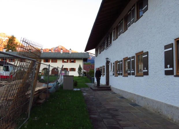
 At the same intersection as Clancy and his buddies were at 70 years earlier to the day. (Compare with photo at start of this post)
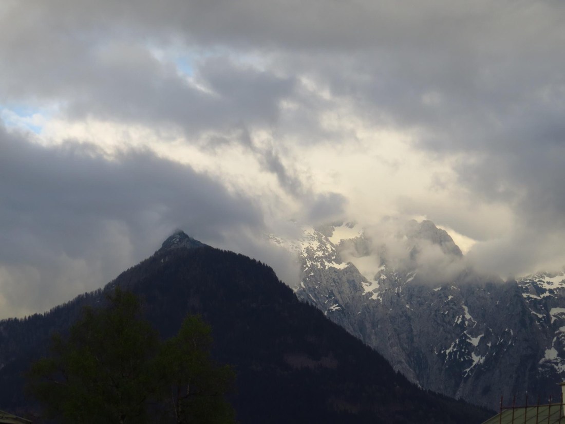 A view of Kehlsteinhaus (The Eagles Nest) from the Chancellery billets. Oddly the view is not mentioned in Webster’s published work.
(*Article originally blogged in December 2015)
*******************************************
Works Cited:
Ambrose, Stephen E. Band of Brothers: E Company, 506th Regiment, 101st Airborne from Normandy To Hitler’s Eagle’s Nest. 1992. New York: Simon & Schuster, 2002. 2nd Touchstone Ed. Print.
Brotherton, Marcus. We Who are Alive and Remain: Untold Stories from The Band of Brothers. 2009. New York: Berkley Calibre (Penguin Group). 1st ed. Print.
Webster, David Kenyon. Parachute Infantry: An American Paratrooper’s Memoir of D-Day and the Fall of the Third Reich. 1994. New York: Dell Publishing, Random House, 2002. Rev. ed. Print.

 The striations created by the layering when the stone was originally formed, made interesting natural patterns that become more stunning on the other side of the arch.
 The rock formations fascinated me with their alternation my angles. I wasn’t sure how best to capture the features. Here you can see they change directions just above the arch and this may have played a structural stability role in why it did not topple.
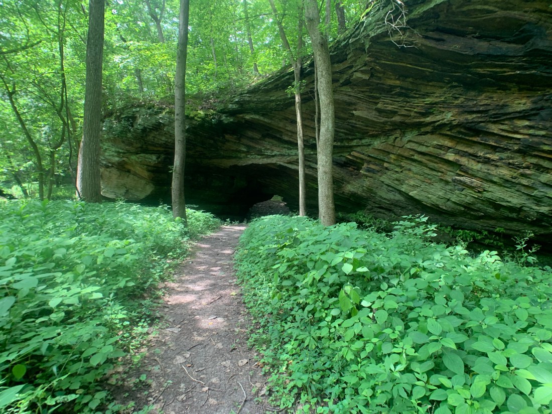 Now the alternating direction of the stone layers became more apparent and beautiful.
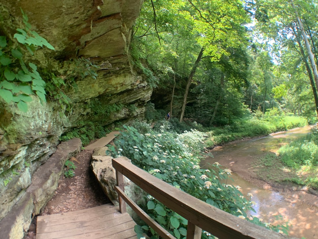


 Hiking on the path near Eiffel Lake.
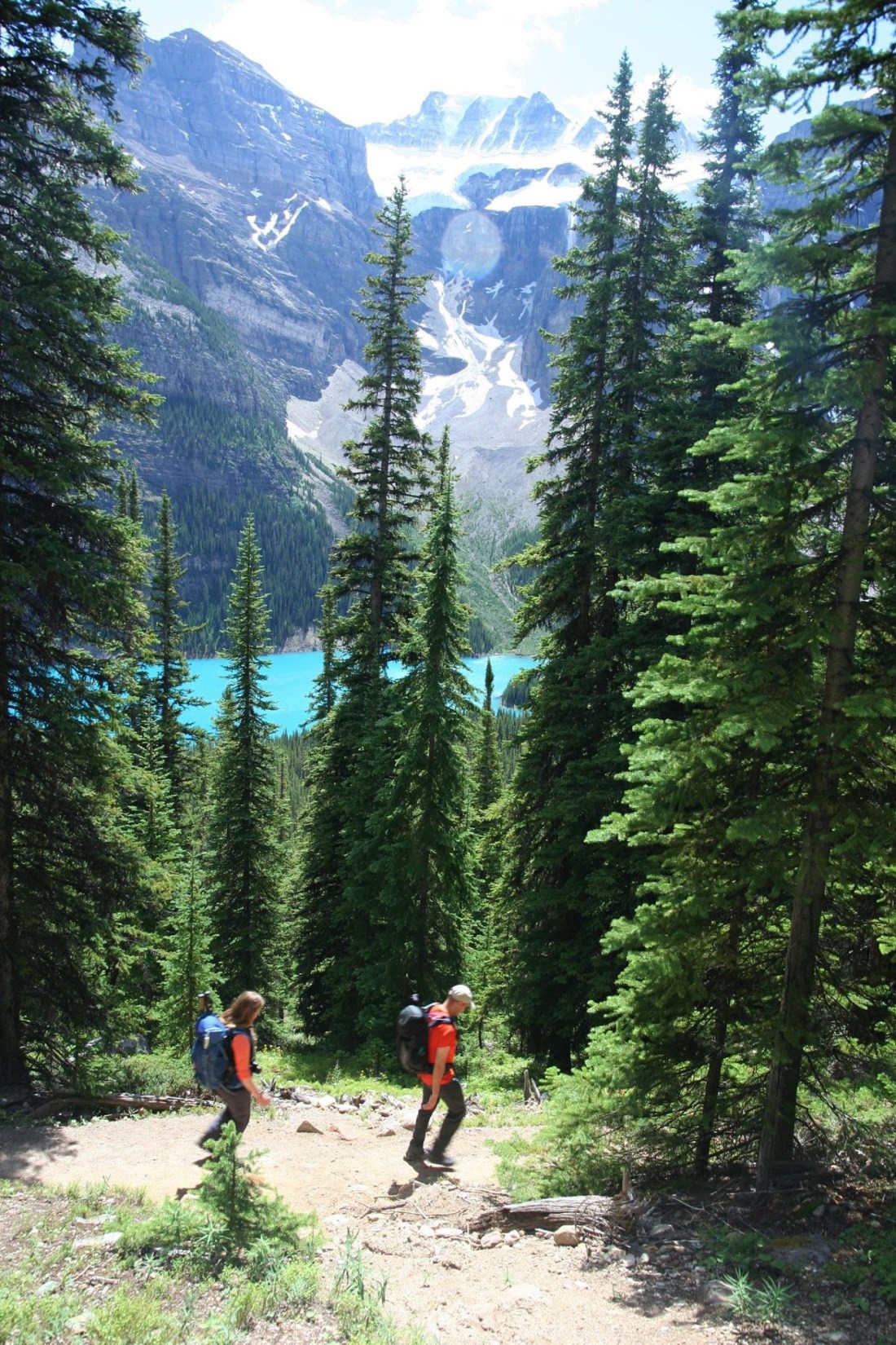 One of several switchbacks rising above Moraine lake on the first leg of our journey. Just a glimpse of some of the 10 peaks through the trees.
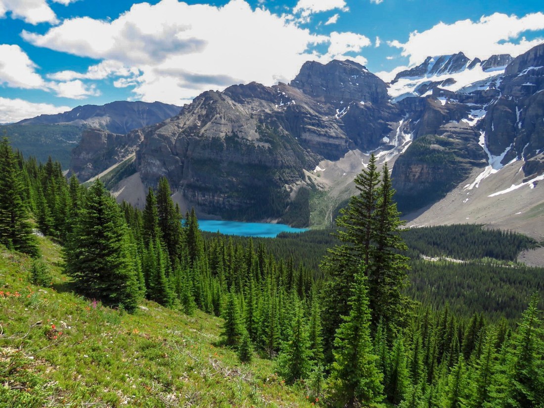 A view back on Moraine lake as the forest opened out to a flowering meadow. The “Tower of Babel” rises above the lake — a short difficult climb with amazing views, I am told.
 Two fellow hikers and our lead continue as the ground began to give way Stoney ground and then scree.
  Eiffel lake finally in view!
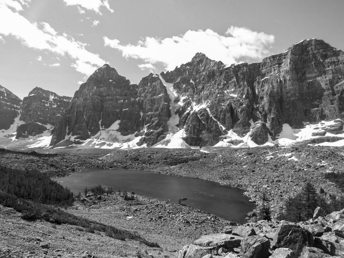 Just above Eiffel lake on the trail looking back on Mt. Perrin, Tuxco, Deltaform and Neptuak.
 A fellow hiker taking a moment to snap a picture of me and Eiffel lake with the base of Mt Neptuak rising on the left and British Columbia just beyond behind. The ridge behind leads up to Wenkchemna Peak in BC.
 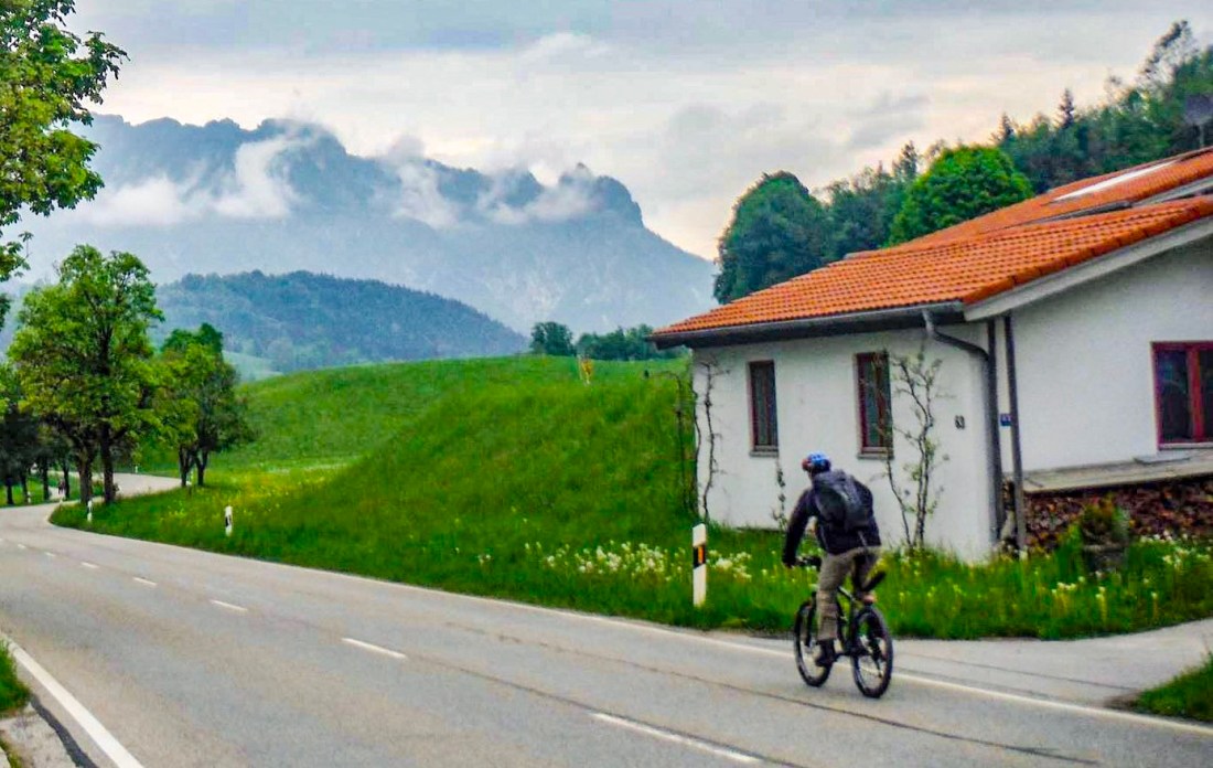 A view back towards The Sleeping Witch mountain at the entrance of the Chancellery complex just outside of Berchtesgaden.
 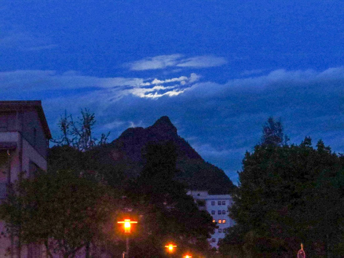 Moon momentarily hiding behind some clouds at around 4 am in Bad Reichenhall.
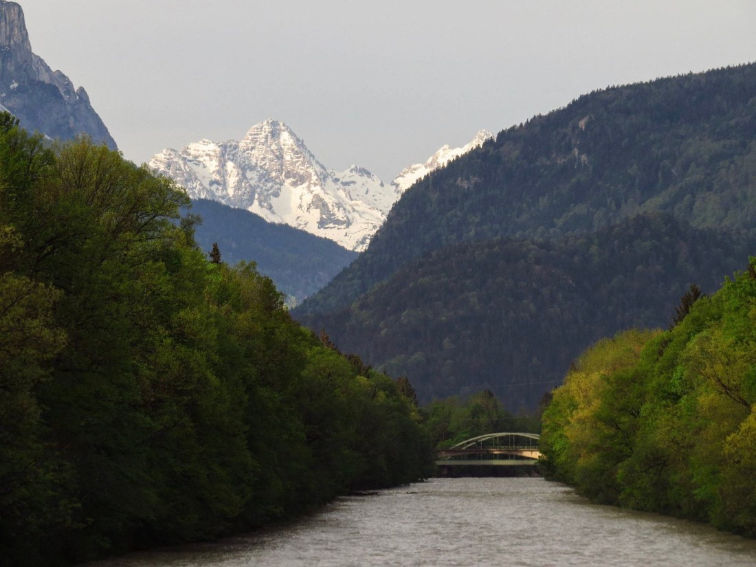 Crossing the Saalach river near Piding.
 The moon from my balcony in Bad Reichenhall.
 Moon momentarily hiding behind some clouds at around 4 am in Bad Reichenhall.
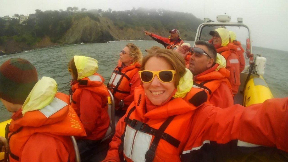 This is what a speedboat tour looks like in San Francisco Bay. Although, at one point it almost didn’t happen.
 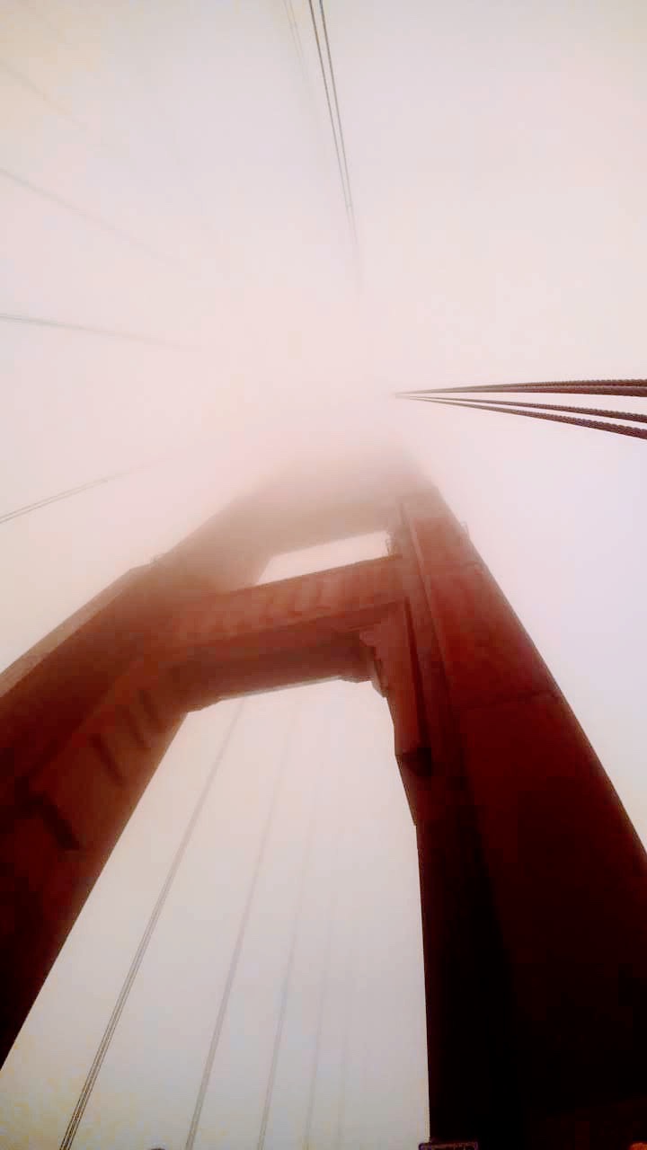 What a view…
 Going under the Golden Gate.
  Our speedboat tour guide, enjoying it as much as us. Also, very knowledgeable. I’d recommend Bay Voyagers for a tour.
 I had only been in Germany a few hours and most of that time was on the road–The Road– you know, the Autobahn.