 Hiking on the path near Eiffel Lake.
Located in Banff National Park in Alberta, Canada and just a short distance from Lake Louise, this moderately rated trail is a good day hike trail pick. It’s about 7 miles long with much of its 1800 foot elevation gain occurring in the first mile and a half of the trail.
There were not too many folks on this trail. It was a pleasant contrast to the shores of Lake Louise. There you almost had to push your way through crowds to walk, especially near the famed hotel. The downside of many people being able to afford travel is that some beautiful places become heavily trafficked making even access (e.g.,parking a problem). On our trip forest fires played into the numbers as some places were closed, forcing tourists and hikers to funnel to other areas.
You can’t blame folks for wanting to see beauty and getting away, but balancing this with the sheer numbers and it’s impact on the environment and other hikers is a difficult question to answer. I’ve seen it at the Grand Canyon and Yosemite. It took from the enjoyment of some areas.
Once it became apparent that seeing some places meant even greater crowds than anticipated, our guide made some alterations to times and places to avoid crowds. The strategy worked pretty well. There is so much beauty to see in the Canadian Rockies you don’t have to go to to see the Insta-famed sites and not at the same height traffic times of day or year.
The trail head, which actually is a connecting trail for our purposes, named Larch Valley trail, rises from iconic Moraine Lake. Definitely stop to take in the view on a short boulder trail at the end of the lake adjacent to the parking lot. A view of the 10 peaks behind the lake made their way on to Canadian currency for a time. And for good reason. It is certainly a breathtaking view — one you can hardly believe is real. Canoes are available for rental, but they are a bit pricey, like Lake Louise. There’s also a gift shop and cafe at the parking lot.
After walking the lakeside boulder trail, we passed the gift shop and followed a series of several switchbacks, which took us up through the coniferous forest. We would follow the trail beyond the Valley of the Ten Peaks and eventually on to “Desolation Valley” and then Eiffel lake itself. Most of our elevation gain took place here on the larch valley trail–the first mile and a half of the trek.
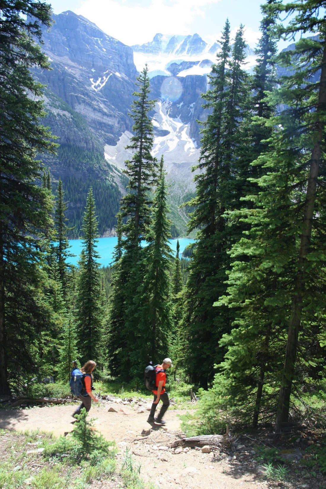 One of several switchbacks rising above Moraine lake on the first leg of our journey. Just a glimpse of some of the 10 peaks through the trees.
Once we got on Eiffel lake trail, things pretty well leveled out. The larch valley trail continues on to Eiffel peak. Our path for the day, went on to the the lake of the same name. We hiked in July so the days were long and warm and most of the snow was gone. Something you want to take into consideration if planning a day hike at a different season.
We moved in small groups according to pace. I typically bounced from front to back of the main body, as I walked faster but would frequently stop to take pictures. A younger couple moved ahead of the group, having a quick pace and traveling light. We’d meet up at the lake.
We were moving along at a reasonable pace. One of our group decided to part company and head up to Eiffel Peak where the trail diverged. It’s a strenuous hike. A handheld radio was handed off to the lone hiker and we agreed to meet back at a certain point and time window on the trail.
The rest of us moved on ahead after having a snack. A little bit of protein. A little bit of salt. And plenty of fluids. Another couple in our group was closely watched and at one pint hassled by an aggressive bird which apparently had learned hikers have food and don’t need all of it. Amusing as long as you aren’t the object of its attention.
Breaks in tree cover eventually opened out to treeless terrain. An array of alpine flowers including occasional strawberry blooms dotted the trail sides. Then, that gave way to a more stark, desolate beauty as seen in the opening picture.
 A view back on Moraine lake as the forest opened out to a flowering meadow. The “Tower of Babel” rises above the lake — a short difficult climb with amazing views, I am told.
I stopped a few times to get pictures of mountain, valley and flowers. The scenery was a little reminiscent of some areas in the Bavarian Alps.
The trail here is relatively level though uneven being intermixed with dirt and larger pieces of rock protruding from the ground. It was a nice changes from the more strenuous switchbacks which afforded little view through the tall trees.
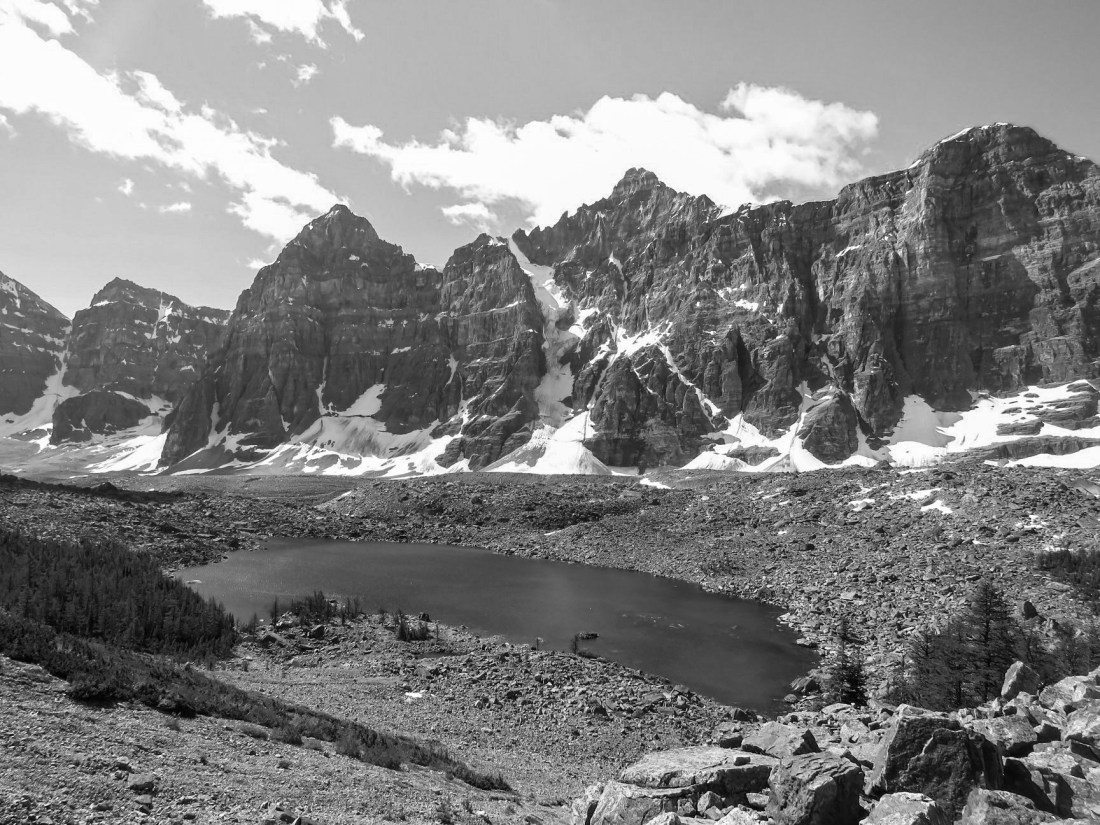
As we entered the Desolation Valley stretch, the dirt gave way to more stone. There were some patches of dirt, and there we spotted a marmot just off the trail among the rocks. It was giving an alarm call for our encroachment on its territory.
Here the trail runs along the base of mount Eiffel. The nature of the terrain prevented a clear view of its peak from our position. And any regular communication on the small hand held radios. The trail was now settled scree for longer stretches as we approached the lake. There were even a few snow patches and even beds still melting down from the winter. We negotiated most of these with relative ease, slipping was the only concern as a sprained ankle would not be fun on the trail.
 Two fellow hikers and our lead continue as the ground began to give way Stoney ground and then scree.
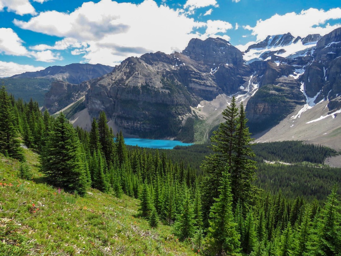
 Eiffel lake finally in view!
The open ground allowed a cool wind to blow off the higher snow covered areas and that prompted us to put our jackets back on. We had taken them off on warming some from the initial morning chill and being sheltered in the sun after the ascent on the larch valley trail.
 Just above Eiffel lake on the trail looking back on Mt. Perrin, Tuxco, Deltaform and Neptuak.
It wasn’t long and we spotted the younger couple sitting among some larger rock near a little running water. This was at some distance, thanks to one wearing bright red. It took a good 15 minutes to walk to them. This was the stopping point for us though the trail branches off and goes on up either to Wastach peak, or staying on the main trail, over the ridge into British Columbia.
We sat down and some had water and a snack as we viewed the lake below. We shot a few more pictures, collected our thoughts, chatted some enjoying the scenery and began the trek back to Moraine lake. Clear weather made it a wonderful day for pictures.
I’d enjoy going back and exploring more trails in that area, even hiking into British Columbia.
 A fellow hiker taking a moment to snap a picture of me and Eiffel lake with the base of Mt Neptuak rising on the left and British Columbia just beyond behind. The ridge behind leads up to Wenkchemna Peak in BC.
 Fellow hiker Daniil enjoying a magnificent view of Yosemite valley due to good planning by our guide, Rich.
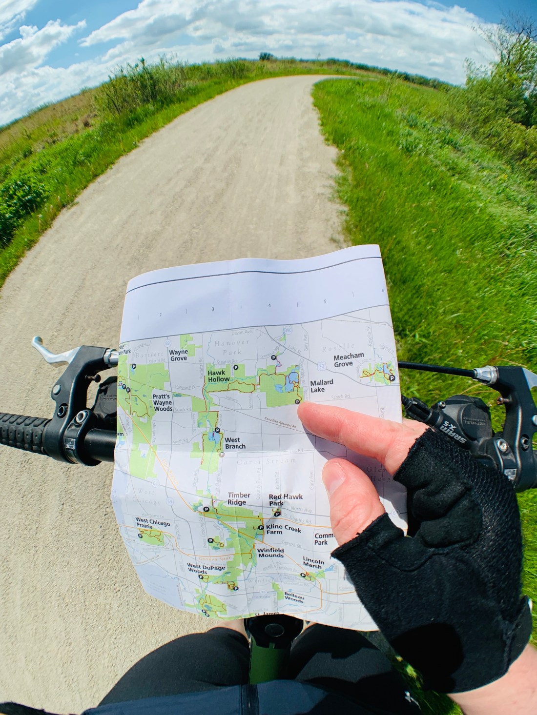 Myself reviewing a map to confirm location and features of my intended route on a recent bike ride.
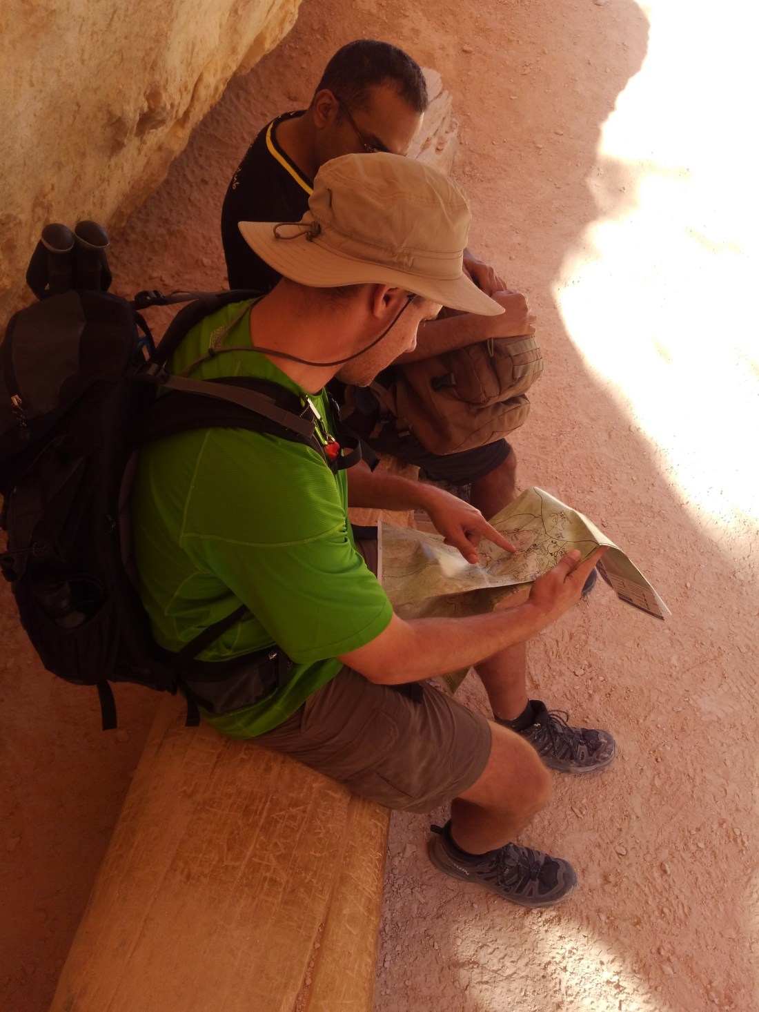 Our guide Rich, reviewing and pointing out features on a trail map for Bryce Canyon.
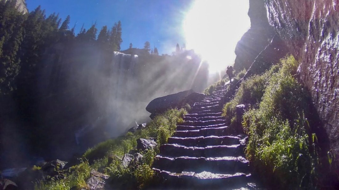 DeeDee, a fellow hiker,ahead of me on the trail. Vernal falls is in the shadow to the left.
  Myself and guide Richard heading up the trail at Vernal falls, one of several waterfall views visible along the Mist trail.
 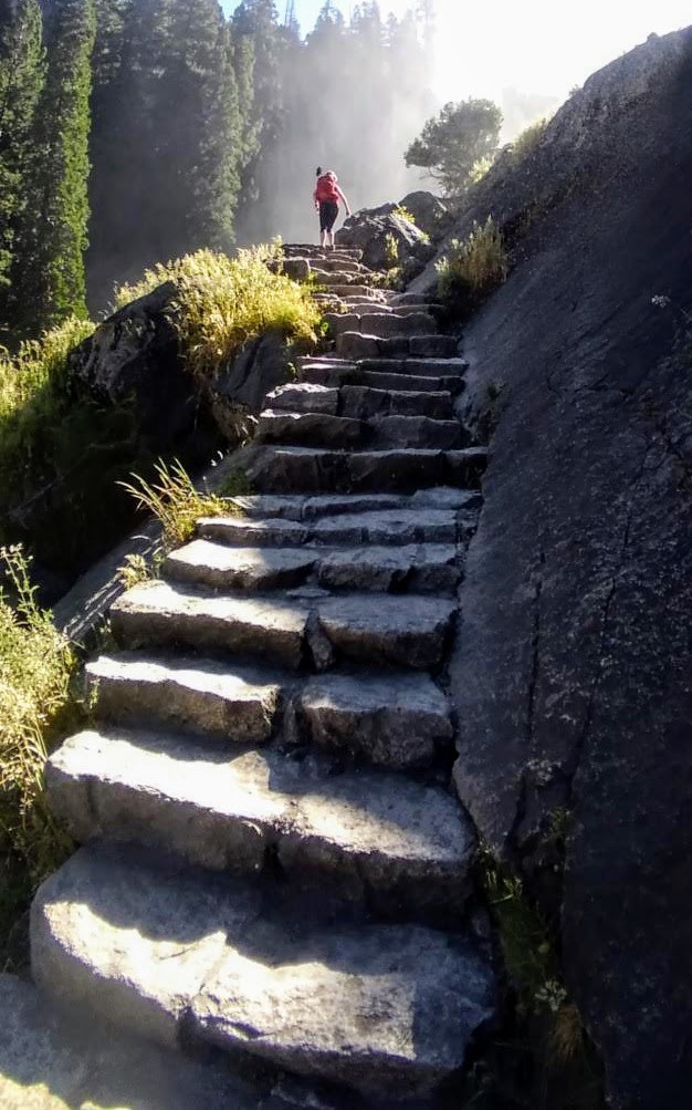 Another shot of DeeDee taking on the myriad of steps at Vernal falls.
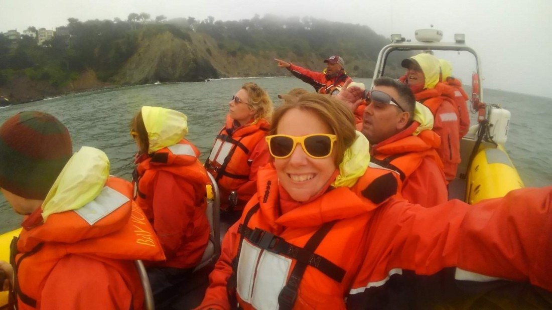 This is what a speedboat tour looks like in San Francisco Bay. Although, at one point it almost didn’t happen.
 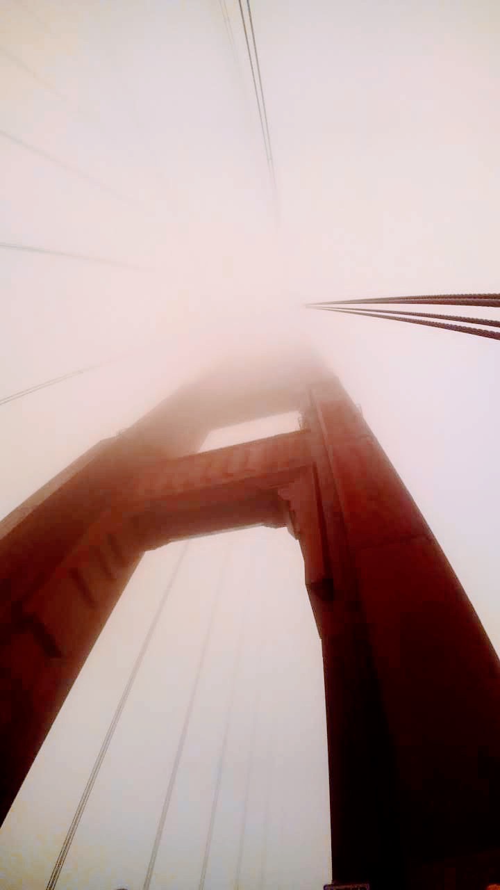 What a view…
 Going under the Golden Gate.
  Our speedboat tour guide, enjoying it as much as us. Also, very knowledgeable. I’d recommend Bay Voyagers for a tour.